
 Get there with Google Maps
1 The easiest way to get to Cortijo la Tenada is to first search for “Campohermoso” on Google Maps.
2 Once in Campohermoso, you can search for “Cortijo la Tenada” or follow this link: https://goo.gl/maps/gMrARfyraSnKkxfMA.
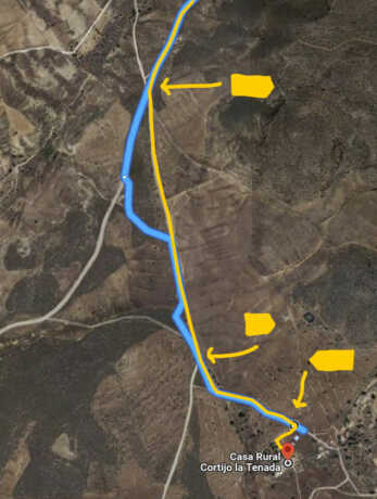
3 You have to be careful in the last km, there are arrows that indicate “Cortijo la Tenada”. Google indicates the old dirt road (see image), the new one leaves a little earlier.
By car
1 From the Mediterranean motorway A-7 directed to Almería, take exit 742 towards Campohermoso-Parque Natural (directed to Murcia exit 747 Níjar-Campohermoso).
Follow the signs to Campohermoso and Las Negras. Once you get to Campohermoso follow the signs for Las Negras Fernán Pérez (total 10km).
2 Before entering the town of Fernan Perez, leaving the aqueduct on your left, turn right and follow the road out just before the sign announcing the town of Fernan Perez. On the left is a white windmill.

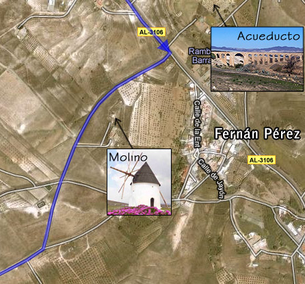
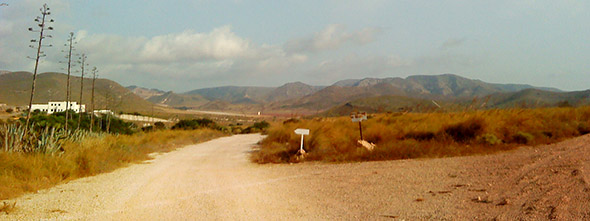
3 Follow the road, pass an olive plantation (“El olivar del Parque Natural”) on your left, after 900m turn into the first dirt road on your left, marked with a yellow sign that says “Cortijo la Tenada” (total 4km).

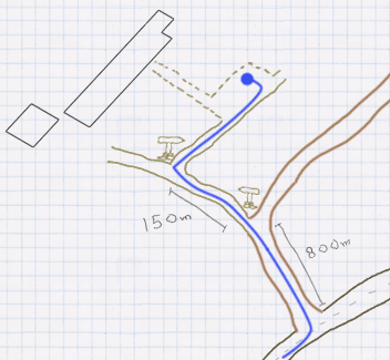
4 From the dirt road you can see the farmhouse, after 800 at the junction turn left, there is a yellow arrow. 150m from junction into the parking on the right, following another arrow.
Airports
Almería 34 km away – destinations and companies
Alicante 260 km away – destinations and companies
Granada 200 km away – destinations and companies
Málaga a 250 km away – destinations and companies
Murcia 190 km away – destinations and companies
Train and bus
Almería train and bus station 43 km:
Train – times and prices
Bus – times and prices
Tren+Autobus – Trainline